Monday, June 30, 2014

David and Elaine


David and Elaine relaxing on their patio.
We joined them there each evening, dining alfresco.

D and E, long term residents of Quincy, WA, spend their winters in Lake Havasu City (LHC).  Before they retired, David was a school principal; Elaine owned and operated a flower shop.  We spent a delightful 3 days with them, with the Cougar parked in their backyard.  David and I, plus 2 other local guys that spend time in LHC, played Pickleball one morning while Trish and Elaine went to a quilt show in Moses Lake.

David and I also played Polish Golf, aka ladder-ball, a couple of afternoons.  Being the tactful, modest person I am, I won't divulge who won the most games.  We tried to get the ladies to join us but they opted out, preferring to get on with their locker-hooking, a new toy they found at the quilt show.

Quincy, population 7,000, has a lot going for it.  Located in central WA on a major cross-country railroad, it's a perfect location for food processing, storage and shipping.  Agribusiness giant, Simplot, has a large facility here, as do many similar companies.  There's a state of the art, intermodal (shipping container), cold storage facility here that covers 7 acres.  No, that's not a typo: it's really a 7-acre refrigerator.  You can store food there, at temps ranging from 20 below to 50 above, in refrigerated shipping containers that can be loaded directly on to flatbed railroad cars and sent off to Chicago or New York. Cool, huh?


The big fridge, picture taken from Monument Hill, a few miles away

Most computer users know what 'the cloud' is but darn few know where it is.  It's right here in Quincy - part of it anyway.  The cloud is data storage, a place to stash your personal computer files, digital pictures etc; it can be used as backup or just to lighten the storage load on your PC.  Microsoft, Yahoo, Intuit and several others have huge data centers here, attracted by the inexpensive electricity and the availability of water for cooling.  Each facility has it's own massive generators that automatically kick in if there's a power failure, thus avoiding a cloudburst.


This outdoor fireplace resides in the corner of D and E's backyard.  I grilled brats and pineapple slices in it one night, and David fired it up again on our last night so the ladies could roast marshmallows.

Wednesday, June 25, 2014

Got Marmots?


Yellow-Bellied Marmot

We sure got ‘em.  They're all over the place.  Yellow-bellied marmots graze in the grass near our campsite at Lincoln Rock SP, retreating to their dens if anyone gets close.  Before now, I’ve only seen marmots rarely, never more than one at a time, and only in remote high-altitude areas, so it was a surprise to see dozens of them here at 725’ altitude in a busy park.  I think the ones I’ve seen before were hoary marmots, not yellow-bellies. 


Lincoln Rock

This Park is on the Columbia River, 8 miles north of Wenatchee, WA.  There’s a bluff across the River that, when viewed at the proper angle, kinda looks like Abe Lincoln’s face in silhouette.  Gotta say that it looks more like Lincoln than Steamboat Rock looks like a steamboat.


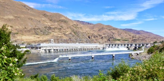
Rocky Reach Dam is ½ mile downriver from our campsite.  
It was completed in 1961 and has 11 hyrdoelectric generators.

Friday, June 20, 2014

Daroga SP, WA


Our campground at Daroga SP
There's some major juice in those electric lines, headed to the Seattle
 area from Grand Coulee Dam.


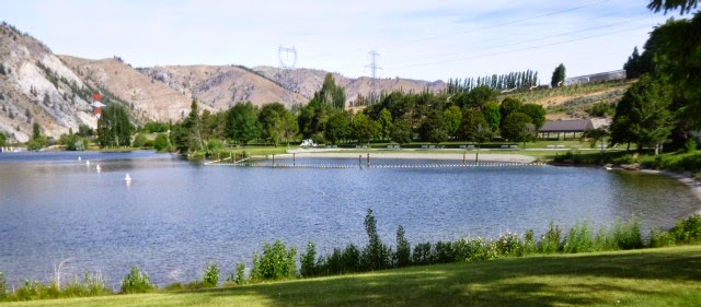
Swimming area in the day use portion of the park

‘Washington State’ was boldly printed on the crates of apples and peaches my dad brought home in the 50s.  The fruit was beautiful and delicious and I thought Washington must be a really wonderful place (and it is) Back then, in my pre-teen years, I didn’t even know where it was.  You could point at Luxembourg on the map and say ‘that's it, there’ and I’d have believed you.  This park is on the Columbia River, several miles north of Wenatchee.  Orchards abound here, as they do all along the River as it winds its way through central and southern WA. 


This pix was taken from the deck of the Oasis Bar at the Desert Canyon golf course, which is near our campground.  We had a fine dinner at the Oasis last night.  The course is very pretty but not our cup of tea: we’re into par-3 courses that charge $2 per hole or less, glorified cow pastures. 

Wednesday, June 18, 2014

Steamboat Rock SP, WA

Steamboat Rock SP, WA

This is a very nice state park with full hookups and dramatic scenery.  It was not on our itinerary: we bagged Farragut SP after 2 nights (had planned on 4) due to cruddy weather.  It’s cruddy here, too, but 10 degrees warmer.


Steamboat Rock
This was taken about 2 miles away from the rock; our campground is right beside it.

Grand Coulee Dam, below, completed in 1942, is a few miles north of us.  It’s nearly a mile wide, one of the largest concrete structures ever built anywhere, and it produces more electric power than any other dam in the US.


The dam is shaped like a hockey stick.  This picture shows the upper end of the stick, looking eastward.  The long concrete structure at the bottom is the west power plant which contains 10 turbines.


This shows the rest of the dam and 2 more power plants.  The smaller plant on the right is a twin of the west end plant and contains another 10 turbines; it's at the bottom of the hockey stick handle.  The larger building on the left is the paddle part of the hockey stick.  It was built in the 70s and contains 6 massive turbines that generate 2/3 of the total power produced here. 

A large number of Chinese laborers worked on the dam and that’s how it got its name.  Do you believe that?  You shouldn’t: it’s pure BS.  It’s actually named after the large coulee (ravine) where it’s located.  But, for many years, I really did think the name referred to Chinese laborers (coolies).  Duh!  The Lake Missoula floods, mentioned in an earlier post, barreled through here in an 800-foot high wall of water and carved out the Coulee. 

Sunday, June 15, 2014

Lake Pend Oreille, Idaho


 Is it pronounced ‘penned oriole’?  Nope.  Not even close.  Yet another thing named by those doggone French fur trappers, it’s pronounced ‘ponderay’.  The trapper dude didn’t bother writing the name down.  Later, an English-speaking dude came along, heard the name, didn’t see it written down anywhere, and so he named the nearby town Ponderay.  It may not have happened exactly that way but that's my story and I'm sticking to it.

The natives in these parts wore seashells in, or hanging from, their ears.  That’s what the words mean: ear hanging.  The Lake is the 3rd largest in total volume in the US, not counting the Great Lakes.  It’s 43 miles long and is 1150’ deep in some places.  We’re at Farragut State Park in northern Idaho, named after Admiral Farragut, the guy who said, ‘Damn the torpedoes!  Full speed ahead’, when engaged in a vicious civil war naval battle. 


From 1942-46, this was the site of the 2nd largest military training facility in the world.  Over 293,000 sailors did their initial (boot camp) training here.  There were 776 buildings back in the day, and an ongoing population of 55,000, including 2,000 civilians.  Now, there’s one building, a museum, that used to be the brig, above


This bronze memorial, above and below, was erected here in 2006.  Many of the sailors who trained here were in attendance at the dedication.  My friend Dave (he's the smaller guy on the right) was in the navy and his dad worked here as a civilian cook.  Look closely at the skin (no, not Dave's; the guy on the left) and you'll see dozens of heads of navy guys.  Several paces away, it looks like a bad case of acne.  


He looks extremely critical and dismayed,
definitely not liking whatever it is he's looking at, Nazis maybe?


Friday, June 13, 2014

Pitch, Sheep, Columbia


Our campsite at Kootenay NP, BC, Canada.
Trish is removing pitch from Ranger's feet.


When we broke camp this AM, there were 8 bighorn sheep browsing through camp.
We saw another parade of bighorns on the golf course the prior morning.
There were a dozen of 'em, casually strolling across the course single file,
 not a care in the world.
One would think they'd get hit with enough golf balls to steer clear.


This is the sign in front of Trish in the picture below.
Visiting the source of the Columbia River was the main reason we went to Canada.
It had been on T's bucket list for some time.


Happy Camper!
Scratch it off the bucket list.

Thursday, June 12, 2014

Kootenay NP, BC, Canada


This stop is a happy accident.  We’d planned to stay at Dry Gulch Provincial Park a few miles to the south but continued on because it had no dump station.  Dumping was mandatory after 4 days without, so we continued north to Radium Hot Springs and found this NP campground with full hookups.  The campground (Redstreak) has 242 sites, 90% of which are unoccupied.


The Columbia River Wetlands, above, are the longest stretch (112 miles) of  undeveloped wetlands in North America.  This picture was taken from an overlook just south of Radium Hot Springs.


This information sign was at the overlook mentioned above.

When we set up camp, it takes about 15 minutes to get the rig chocked, unhooked from the pickup, leveled, stabilized, and hooked up to utilities.  While we’re doing the setup, Artie and Ranger inspect the campsite and check their pee-mail.  Turns out, the pee-mail locations were booby trapped with pitch from evergreen trees.  Trish spent a tedious hour removing the nasty stuff from their paws and elsewhere, no end to the fun.

There was a group – herd, flock, gang, whatever -  of mountain goats hanging out behind the visitor center where we stopped to inquire about dump stations, have never seen them that close to civilization.


Monday, June 9, 2014

Al and Natalie


Al and Natalie’s place near Missoula, MT
What a lovely, peaceful setting!

Western Montana, with its broad valleys and mountain ranges, has always appealed to me.  I’ve driven through it numerous times and it’s always been a ‘wow’ experience.  We are parked near Missoula, at the home of Al and Natalie.  Al is a college friend who taught school here, as did his wife, Natalie.  Their home is on a 5-acre parcel, surrounded by mountains, quite close on one side, many miles distant on the others.


The view to the north


Al working on Natalie’s honey-do chores

A and N live on Big Flat Road.  The road itself is neither big nor flat, but the area it serves is very much so.  Near the end of the last ice age, 13-16,000 years ago, Glacial Lake Missoula broke through the ice dam on the Clark Fork River and resulted in cataclysmic flooding.  This occurred over and over, 25 times or more.  The floods waters, with a volume 13 times that of the Amazon, and moving at 80 MPH, headed westward to the Pacific.  En route, they carved the Columbia Gorge, flooded the Willamette Valley down to Eugene, OR and beyond – and, of course, created A and N’s Big Flat.  Surfers, imagine hopping on your board in Montana and riding that massive wave all the way to the Pacific!  Wear your life jacket and pack a lunch.


 I’m a sucker for funny labels on beer and wine.  
Saw this one in a store in Butte, had to buy it.

Thursday, June 5, 2014

Yellowstone NP

Wildlife abounds here and we were delighted to see 2 1/2* grizzlies and a wolf.  Buffalo are plentiful but we only saw one elk and no moose at all.  But, there was a young moose hanging out in our campground near Swan Valley, southwest of Jackson, WY.


Mammoth Hot Springs viewed from upper terrace drive.

Volcanism is what makes this park unique: geysers, boiling mudpots, fumaroles, hot springs, colorful mineral terraces, they’re all here.  Much of the park is within the 30 x 45 mile wide caldera that marks the last major eruption 640,000 years ago.  That eruption spewed up 240 cubic miles of debris.  Compare that to the Mt St Helens eruption in 1980, which resulted in a 1 x 2 mile wide caldera and 0.3 cubic mile of debris.

Yellowstone erupts every 600-700,000 years, so the next blow could occur any time.  That thought inspired me to write:

Yellowstone
Tourist plans will be disrupt
When Yellowstone starts to erupt.
In fact, I venture to say
The tourists will be blown away.


Above is the rear view of the Old Faithful Inn, built in the winter 1903-4.
It's all logs with lots of character, love it!


The 65' high lobby.
Note how tree limbs were used on the balconies.
Gnarly!


The front of the Old Faithful Inn.


The new Education and Visitor center is beside the Old Faithful Inn.

*Trish says she saw a 3rd griz but I don't recall seeing it and don't recall Trish commenting on it.  So, I'm counting that as a half griz.

Wednesday, June 4, 2014

Grand Teton NP


The Grand Tetons above, Craig Thomas Visitor Center below.

The popular story about the GT name origin is that a French-Canadian fur trapper thought they looked like big boobs – Grand Tetons in French.  The less popular story is that they were named for or by the Teton Sioux.  In any case, they are indeed grand.  But – they don’t look like women’s breasts at all. 


Above and below: Jackson Lake


North end of Jackson Lake, taken from Jackson Lake Lodge.

Davey Jackson was a fur trapper who traveled around naming everything he could find after himself.
Not a very modest fellow, I guess.